The water you sail on
Trinity Inlet: port, mangroves, Gimuy
What Trinity Inlet is: the port of Cairns in an old river delta, lined with mangroves, and part of the country the Yidinji call Gimuy.
Book dinner on Trinity Inlet ↗Quick answer
Trinity Inlet is the oceanic inlet that serves as the port of Cairns, with the city centre on its western bank where the inlet meets the Coral Sea. It sits in the original delta of the Mulgrave River and is lined with mangroves and mudflats. The area is known in the Yidiny language as Gimuy.
A port in a river delta
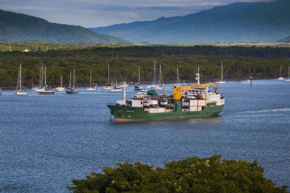
Trinity Inlet is an oceanic inlet that serves as the port for Cairns. The city centre stands on its western bank, where the inlet meets the Coral Sea. Wikipedia places the inlet in the original delta of the Mulgrave River, which now reaches the sea at Russell Heads, about 30 km to the south. The dinner cruise sails on the northern part of this water, close to the city's own foreshore, and it starts and finishes at the marina on the city side.
Mangroves and mudflats
The inlet is lined with mangroves and mudflats. A mangrove is a shrub or tree that grows mainly in coastal saline or brackish water, and mangrove forests are found in tropical and subtropical tidal areas. Their aerial roots, called pneumatophores, let them take in gases directly from the air. Seen from the water at dusk, the shoreline is the dark, even edge between the lit city and the inlet, and knowing what it is made of explains why the bank looks so uniform.
A protected nursery
The Queensland Government lists Trinity Inlet as a declared Fish Habitat Area of 7,164 hectares. It describes extensive mangrove forests of Rhizophora, Avicennia and Ceriops, and calls the area an important nursery for several species of fish and penaeid prawns. The original declaration, in September 1989, covered Admiralty Island and the Trinity Inlet reserves. Wikipedia adds that mangrove swamps protect coasts from erosion and storm surge, which is a useful job on a coast that sees tropical cyclones.
Admiralty Island and the working port
A large mud island has formed inside the inlet and carries the name Admiralty Island. Wikipedia describes the inlet as providing limited deep-water berthing for the port, with the export of cane sugar, and notes that the region's only tanker berth and the Royal Australian Navy base HMAS Cairns are on it. Tour operators that visit the Great Barrier Reef work from the Reef Terminal at the entrance, so the same water carries sugar exports, naval vessels and reef boats.
Gimuy
The area where Cairns stands is known in the Yidiny language as Gimuy. Before British settlement it was inhabited by the Gimuy Walubara Yidinji people, who still claim their native title rights, and Wikipedia calls the Gimuy-walubarra the clan of the region. The same article describes the inlet as sacred to the Yidinji peoples of Gimuy for its rich cultural stories, among them Kuyala the Sea Eagle. Respect is the reasonable response: the stories belong to the Yidinji, and this guide repeats only what Wikipedia records.
A city that began on swamp
Cairns was founded in 1876 as a port for the Hodgkinson goldfields and named after the then Governor of Queensland, Sir William Wellington Cairns. Wikipedia says the site was predominantly mangrove swamps and sand ridges, which labourers gradually cleared and filled. The mudflat under the foreshore is the ground the city was built on, which is why the waterfront looks the way it does. A harbour board followed in 1906, and the port has grown around the inlet ever since.
Who this isn't for
This is not a wildlife tour, and no bird, fish or reptile is promised on any sailing. The operator describes a dinner cruise on Trinity Inlet and the Cairns waterfront, and what you see depends on the tide, the light and the route on the night, and the operator does not describe any wildlife as part of the evening. Anyone who wants a close look at the mangroves and their animals needs a different kind of boat trip, with a guide who is there to talk about them.
Frequently asked questions
Is Trinity Inlet a river?
No. Wikipedia calls it an oceanic inlet that serves as the port of Cairns. It lies in the old delta of the Mulgrave River, which now enters the sea further south.
What does Gimuy mean?
Gimuy is the name for the Cairns area in the Yidiny language. Wikipedia names the Gimuy-walubarra as the clan of the region before settlement.
Are the mangroves protected?
Yes. The Queensland Government lists Trinity Inlet as a declared Fish Habitat Area, with extensive mangrove forests and a role as a nursery for fish and prawns.
Sources